ON THIS DAY · AUGUST 2, 1989
How the World Learned to Navigate: The 1989 Launch of Block II GPS That Guided Global Consumer Navigation
Before August 2, 1989, global satellite positioning was an experimental military proof-of-concept. When the operational Block II Navstar satellite reached orbit, it laid the foundation for the 24-satellite constellation that powers every modern smartphone map, airline route, and autonomous vehicle today.
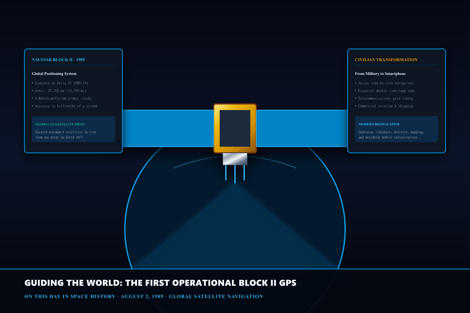
From Experimental Block I to Production Block II Satellites
Between 1978 and 1988, the Department of Defense deployed eleven experimental Block I Navstar satellites to validate the physics of space-based radio-trilateration. While Block I proved that synchronized atomic clocks could determine precise position coordinates, the satellites had limited operational lifespans and required frequent ground tracking corrections.
The Block II series, manufactured by Rockwell International, was engineered for industrial robustness. Weighing approximately 1,660 kilograms with solar panels deployed, each satellite incorporated redundant atomic frequency standards, hardened electronics to survive coronal mass ejections, and advanced propellant reserves for seven-and-a-half years of orbital station-keeping.
The Physics of Nanosecond Precision and Relativistic Time
Global Positioning System operations rely on a fundamental mathematical principle: measuring the time difference of arrival (TDOA) of speed-of-light radio signals transmitted by at least four satellites. To calculate an observer's latitude, longitude, altitude, and receiver clock bias, onboard atomic clocks must remain synchronized within nanoseconds.
Crucially, GPS engineering provided one of the first large-scale engineering validations of Einstein's general and special relativity. Because satellites move at high velocities (special relativity causes clocks to tick slower by 7 microseconds per day) and reside in weaker gravitational fields 20,200 km above Earth (general relativity causes clocks to tick faster by 45 microseconds per day), engineers pre-adjusted satellite clock base frequencies from 10.23 MHz to 10.22999999543 MHz so they would match ground clocks in orbit.
Civilian De-escalation and the Modern Navigation Infrastructure
Although GPS was initially developed for strategic defense missile guidance and naval fleet navigation, President Ronald Reagan issued an executive order in 1983 mandating civilian access following the shootdown of Korean Air Lines Flight 007. In the 1990s, civilian signals were intentionally degraded via 'Selective Availability,' introducing artificial timing errors of up to 100 meters.
On May 1, 2000, Selective Availability was permanently deactivated, unlocking instant 3-meter accuracy for commercial receivers. Today, the GPS constellation underpins trillions of dollars in global financial transactions (via synchronized microsecond timestamping), precision agriculture, automated container shipping logistics, and ubiquitous consumer location services.
What the evidence does not settle
GPS signals are passive, line-of-sight microwave broadcasts that cannot penetrate deep underwater, dense subterranean tunnels, or heavy reinforced concrete structures. Users in dense urban canyons frequently experience multipath interference where signals reflect off skyscraper glass before reaching receiver antennas.
PRODUCT IDEA 01
Garmin Handheld Outdoor GPS Navigator with Topographic Maps
A rugged, multi-GNSS outdoor receiver featuring GLONASS/Galileo support, 3-axis electronic compass, and preloaded topographic trail data for reliable off-grid wilderness navigation.
Buying limit: Look for IPX7 waterproof ratings and dual-battery power compatibility. Professional outdoor navigators range from $180 to $350.
Original editorial illustration, not a retailer photograph. No exact Amazon offer passed our verification gate.PRODUCT IDEA 02
Precision Sighting Compass with Adjustable Declination
A military-grade liquid-filled sighting compass with clinometer and luminous dial markers, providing indispensable analog navigation backup when digital devices lose battery power.
Buying limit: Ensure the baseplate features clear 1:24,000 map scale indicators and optical mirror sighting. Quality navigational compasses cost $25 to $60.
Original editorial illustration, not a retailer photograph. No exact Amazon offer passed our verification gate.SOURCES, METHOD, AND LIMITS
Researched using US Space Force GPS Directorate historical launch records, IEEE Aerospace and Electronic Systems Society archives, and relativistic timing papers from the National Institute of Standards and Technology (NIST). No commercial products were physically tested.
- US Space Force Space Systems Command — GPS Constellation History & Block II Overview — Official military history documenting the Delta II launch cadence, satellite block architectures, and orbital maintenance protocols.
- NIST Time and Frequency Division — Relativity in the Global Positioning System — Primary technical analysis by Neil Ashby examining gravitational redshift and orbital time dilation compensations in satellite atomic clocks.